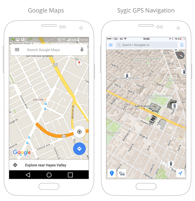
GPS and Google Maps Navigation: How They Work Together
Google Maps navigation helps drivers, cyclists, pedestrians, and transit riders find routes and reach destinations. On a phone or compatible vehicle display, it combines location information from GPS with map data, traffic updates, and other signals to provide turn-by-turn directions.
What GPS Does
GPS, or the Global Positioning System, is a satellite-based system that helps a device estimate its location. A phone usually receives signals from multiple GPS satellites and uses them to calculate its position. Depending on the device and conditions, it may also use cellular networks, nearby Wi-Fi networks, and other sensors to improve or supplement that estimate.
GPS helps determine where you are, but it does not provide a complete map or decide which road to take. A navigation app such as Google Maps combines your estimated location with digital map information to guide you along a route.
How Google Maps Navigation Works
When you enter a destination, Google Maps uses its map data to identify possible routes. It can consider factors such as road connections, travel mode, distance, and available traffic information. After you choose a route and start navigation, the app displays your position and provides directions as you move.
As your location changes, Google Maps compares your estimated position with the route. If you miss a turn or take a different road, the app may recalculate directions. When available, traffic information can help the app estimate travel times and suggest another route.
Using Navigation on the Road
For a smoother trip, enter your destination before you start driving. Mount your phone securely where it does not block your view, and connect it to a charger for longer journeys. If your vehicle supports Android Auto or Apple CarPlay, you may be able to display Google Maps on the vehicle’s screen.
- Review the route before departing, including major turns and estimated travel time.
- Follow road signs and local traffic laws, even if they differ from an app’s directions.
- Use voice guidance when possible so you can keep your attention on the road.
- Pull over safely before changing settings or searching for a new destination.
Using Google Maps Offline
In areas with limited or no mobile data service, downloaded maps can help you navigate. Before leaving, download the area you expect to visit while connected to the internet. Offline features may be limited: traffic information and some alternate routes generally require a data connection, and availability can vary by location and device.
Why Your Location May Be Inaccurate
GPS accuracy can change with the surroundings. Tall buildings, tunnels, indoor spaces, dense tree cover, and poor satellite visibility may cause your location to appear delayed or shifted. A weak internet connection can also affect access to updated maps and traffic information.
If your position seems wrong, move to a place with a clearer view of the sky, check that location services are enabled, and make sure Google Maps has permission to access your location. Restarting the app or following your device’s location-calibration instructions may also help.
GPS Navigation and Safe Driving
GPS navigation is a useful aid, but it should not replace attentive driving. Directions may be outdated, incomplete, or affected by road closures and changing conditions. Stay alert, obey posted signs, and use your judgment. A passenger can help manage navigation, or you can stop somewhere safe before making changes.
Conclusion
GPS provides an estimate of your location, while Google Maps combines that location with digital maps and available travel information to guide you. Understanding how the two work together—and preparing for weak signals or limited connectivity—can make navigation more convenient and reliable.
Google Maps GPS Navigation: 8 Frequently Asked Questions
- How do I use GPS navigation in Google Maps?
- Why is my location inaccurate in Google Maps?
- How can I improve GPS accuracy in Google Maps?
- Can I use Google Maps navigation without an internet connection?
- How do I download Google Maps for offline navigation?
- Why is Google Maps not giving voice directions?
- How does Google Maps choose the fastest route?
- How do I get Google Maps navigation on my car’s screen?
How do I use GPS navigation in Google Maps?
To use GPS navigation in Google Maps, open the app, enter your destination in the search bar, and tap Directions. Choose your travel mode, select a route, then tap Start to begin turn-by-turn guidance. Make sure location services are enabled and Google Maps has permission to access your location. Follow the on-screen directions or voice prompts, while staying alert and obeying road signs and traffic laws.
Why is my location inaccurate in Google Maps?
Your location may be inaccurate in Google Maps when your device has a weak GPS signal, such as indoors, in a tunnel, or among tall buildings. Location permissions, disabled location services, a low battery, or an unreliable internet connection can also affect accuracy. Try moving outdoors to an open area, turning on your device’s location services, checking that Google Maps has permission to use your location, and following the app’s calibration prompt if one appears.
How can I improve GPS accuracy in Google Maps?
To improve GPS accuracy in Google Maps, turn on your device’s Location Services and set location accuracy to its highest available setting. Make sure Google Maps has permission to access your location, then use the app’s calibration prompt if your position appears inaccurate. Moving outdoors or away from tall buildings, tunnels, and dense tree cover can help your device receive GPS signals. A stable internet connection may also improve location estimates and map updates.
Can I use Google Maps navigation without an internet connection?
Yes, you can use Google Maps navigation without an internet connection if you download the map of your destination area in advance while connected to Wi-Fi or mobile data. Offline maps can provide driving directions within the downloaded area, but live traffic updates, alternate routes, and some other features may not be available. Downloaded maps also expire and may need to be updated, so check them before you travel.
How do I download Google Maps for offline navigation?
To download Google Maps for offline navigation, open the app while connected to the internet, search for the area you want to use, and tap the place name or address. Tap the three-dot menu, choose “Download offline map,” adjust the map area if needed, and tap “Download.” You can also tap your profile picture, select “Offline maps,” and choose “Select your own map.” Download maps over Wi-Fi when possible, and update them before they expire. Offline navigation has limitations: live traffic, some alternate routes, and public transit, walking, or cycling directions may not be available.
Why is Google Maps not giving voice directions?
Google Maps may not give voice directions if voice guidance is muted, the guidance volume is too low, or your phone is sending audio to a Bluetooth device or car stereo. While navigation is active, tap the sound icon and select an option with voice guidance, then check Google Maps’ navigation settings and your device’s media volume. If the issue continues, disconnect Bluetooth, restart the app, and make sure your phone’s audio is working.
How does Google Maps choose the fastest route?
Google Maps estimates the fastest route by comparing available roads and calculating travel times using factors such as distance, speed limits, road type, and current traffic conditions. When live traffic data is available, it can account for slowdowns, crashes, or closures and may suggest a different route if it expects that option to save time. These estimates can change during a trip, so the fastest route may not always be the shortest—and actual travel times can vary.
How do I get Google Maps navigation on my car’s screen?
To use Google Maps on your car’s screen, connect a compatible phone to a vehicle that supports Android Auto or Apple CarPlay. Depending on your car and phone, the connection may be wireless or require a USB cable. Open Google Maps on your phone or select it from your car’s display, then choose a destination and start navigation. Check your vehicle’s manual for setup instructions, and set your destination before driving.