Handheld Marine GPS Units: A Practical Guide for Boaters
A handheld marine GPS unit can help boaters determine their position, plan routes, and navigate with greater confidence. Unlike a chartplotter installed on a boat, a handheld device is portable and can be carried on deck, kept in a ditch bag, or used as a backup if onboard electronics fail. Choosing the right model depends on where and how you boat, the charts and features you need, and how you plan to keep the device powered and protected.
What Is a Handheld Marine GPS?
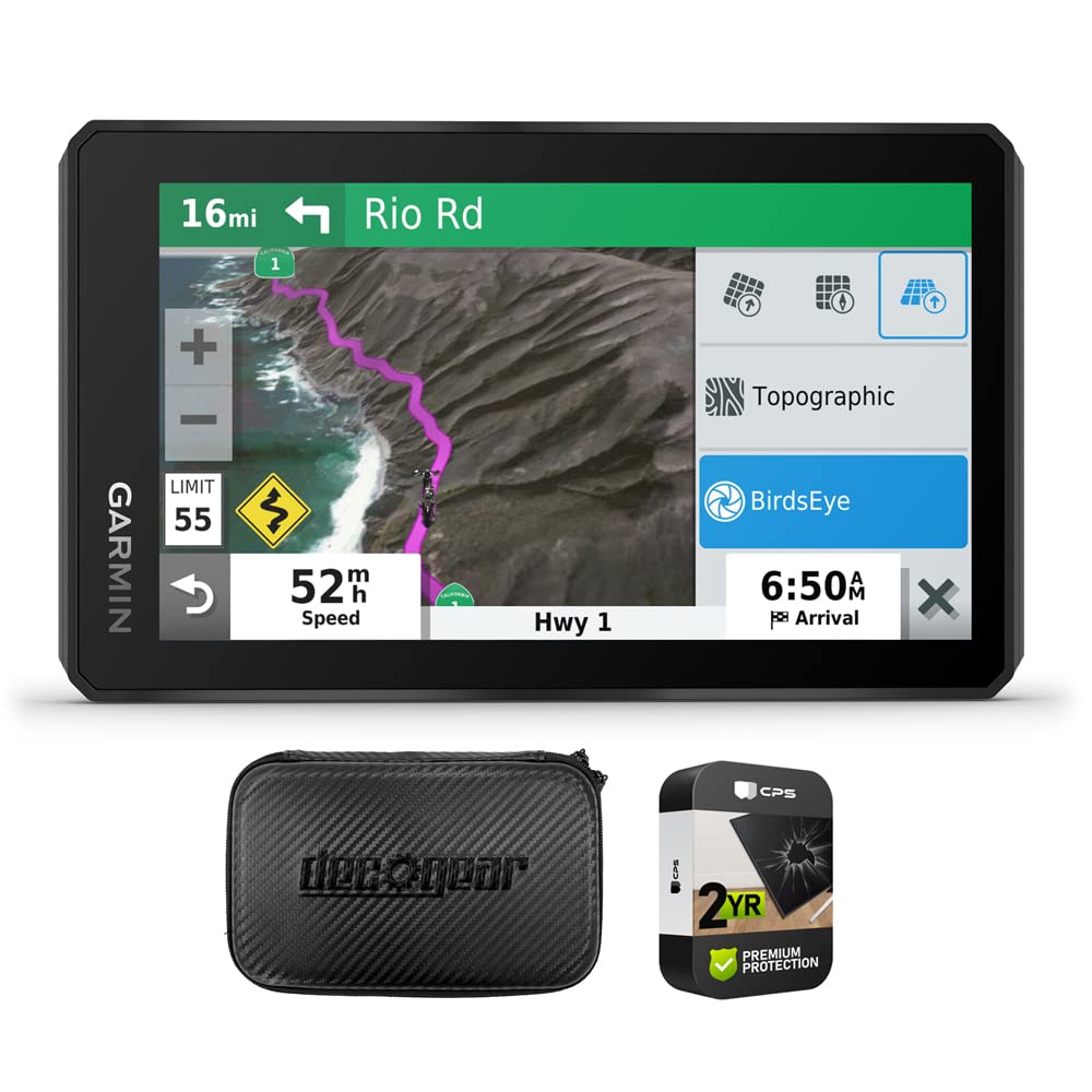
A handheld marine GPS uses satellite signals to calculate your location. Depending on the model, it may also display electronic nautical charts, save waypoints, record tracks, and help you follow a planned route. Some units are designed specifically for marine use, while others are multipurpose GPS devices that can also support hiking, road travel, or other activities.
Handheld GPS units are useful on small boats, kayaks, and tenders, as well as on larger vessels where a portable backup is valuable. They can also be handy when navigating away from the helm or checking your position on shore.
Features to Consider
Marine Charts and Map Compatibility
Not every handheld GPS includes detailed marine charts. Some show only a basic map or a position display, while others support downloadable nautical charts. Before buying, check which chart formats the device accepts, whether charts are included, and whether updates require a separate purchase or subscription.
Make sure the charts cover the waters you plan to travel. Electronic charts are a useful navigation aid, but they should not replace official paper charts or other required safety equipment.
Water Resistance and Durability
Marine electronics are exposed to spray, rain, sun, and occasional drops. Look for a device with a clearly stated water-resistance rating and a design suited to boating. A protective case, screen cover, and secure lanyard can add another layer of protection, especially on small craft or in rough conditions.
Screen Size and Readability
A larger screen can make charts easier to read, but it may also make the device less compact. Consider whether you need to view detailed charts at arm’s length or mainly want a quick position check. A bright, high-contrast display and physical buttons can be helpful in direct sunlight, with wet hands, or while wearing gloves.
Battery Life and Power Options
Battery life varies by model and depends on settings such as screen brightness, backlighting, and wireless connectivity. Check the manufacturer’s estimates and consider how long your typical trips last. Rechargeable batteries may be convenient for frequent use, while devices that accept standard batteries can be easier to power when away from a charging source. Carry spare batteries or a suitable power bank when appropriate.
Waypoints, Routes, and Track Logs
Waypoints let you save important locations, such as a launch ramp, harbor entrance, fishing spot, or safe anchorage. Route planning can help you organize a trip in advance, while track recording shows where you have traveled. Learn how to save and retrieve this information before heading out, and avoid relying on a single device to preserve important navigation data.
Connectivity and Additional Sensors
Some handheld units can connect to compatible marine electronics or mobile devices. Depending on the model, connectivity may allow data sharing, notifications, or access to additional information. Certain devices may also include a compass, barometric altimeter, or satellite communication features. Confirm what is included and whether any functions require a separate service or subscription.
Handheld GPS vs. a Phone App
A smartphone navigation app can be convenient and affordable, especially when paired with downloaded maps and a waterproof case. However, phones may be harder to operate with wet hands, can be vulnerable to water damage, and may have shorter battery life during continuous use. A dedicated handheld GPS is generally designed for outdoor use and can provide a dependable navigation option independent of cellular coverage.
Neither option should be treated as foolproof. GPS reception, electronic devices, and batteries can all be affected by conditions or equipment failure. Boaters should carry appropriate backups and know how to navigate without relying solely on electronics.
How to Choose the Right Unit
- Match the device to your boating: A kayak angler may prioritize a compact, waterproof unit, while a coastal cruiser may need detailed charts and route planning.
- Check chart coverage: Confirm that the charts are suitable for your usual waters and understand the cost and process for updates.
- Test the controls: Buttons, menus, and screen visibility matter when conditions are wet, windy, or bright.
- Plan for power: Compare battery options and bring a backup power source for longer trips.
- Review mounting and carrying options: A lanyard or compatible mount can help keep the unit accessible and secure.
- Understand limitations: Learn what the device can and cannot do, including whether it offers charts, a compass, or emergency communication.
Safe Use on the Water
Set up your handheld GPS before departure. Save key waypoints, check the chart area, charge the device, and confirm that it receives a position fix. Keep it secured where it can be reached without distracting the operator. If the screen is difficult to see in sunlight, adjust the display settings before conditions become challenging.
Use GPS information alongside your surroundings, local knowledge, weather reports, and appropriate nautical charts. Always maintain a proper lookout and follow applicable navigation rules. A handheld marine GPS is a valuable tool, but it does not replace sound judgment, boating skills, or required safety equipment.
Conclusion
The best handheld marine GPS unit is one that suits your vessel, boating environment, and navigation needs. Chart support, water resistance, screen readability, battery options, and simple controls are all worth considering. With the right device—and a backup plan for power or equipment failure—a handheld GPS can be a useful companion on the water.
8 Essential Tips for Using Handheld Marine GPS Units
- Choose a waterproof unit rated for marine use.
- Check battery life before leaving shore.
- Carry spare batteries or a power bank.
- Load current nautical charts before your trip.
- Enable GPS tracking to record your route.
- Use a lanyard to prevent accidental drops.
- Keep the unit in a clear view of the sky.
- Carry a compass and paper charts as backups.
Choose a waterproof unit rated for marine use.
Choose a waterproof handheld GPS rated for marine use to help protect it from rain, spray, splashes, and the occasional drop overboard. Check the manufacturer’s water-resistance rating and care instructions, since “waterproof” does not always mean a device can withstand prolonged submersion. A secure lanyard and protective case can provide added peace of mind on deck.
Check battery life before leaving shore.
Check your handheld marine GPS battery before leaving shore, and make sure it has enough charge for your entire trip. GPS features and bright screens can use power quickly, so bring spare batteries or a charged power bank if your device supports them. Starting with a full charge helps ensure your unit is ready when you need to check your position or follow a route.
Carry spare batteries or a power bank.
Carry spare batteries or a fully charged power bank to keep your handheld marine GPS running throughout your trip. GPS use, bright screens, and cold weather can drain power faster than expected, so check your device’s battery requirements before you leave. Store backup power in a dry, secure place and make sure it’s easy to reach if the battery runs low.
Load current nautical charts before your trip.
Load current nautical charts onto your handheld marine GPS before leaving the dock. Updated charts can show important details such as channels, hazards, depth information, and markers, helping you plan a safer route. Check that the charts cover your entire trip area and that they’re available offline, since cellular service may be limited or unavailable on the water.
Enable GPS tracking to record your route.
Enable GPS tracking before you get underway to record your route as you travel. A track log can help you retrace your path, review where you’ve been, and mark useful locations for future trips. Check that tracking is turned on, your device has enough battery life and storage, and the recorded track is easy to find before you head out.
Use a lanyard to prevent accidental drops.
Attach a lanyard to your handheld marine GPS and secure it to your wrist, life jacket, or a fixed point on the boat. A sudden wake, slippery hands, or a quick movement can send the device overboard, and a lanyard helps keep it within reach. Choose a strap that won’t interfere with safe movement, and check that it’s firmly attached before heading out.
Keep the unit in a clear view of the sky.
Keep your handheld marine GPS unit in a clear view of the sky for the best chance of receiving a strong, reliable satellite signal. Avoid placing it under a roof, inside a closed compartment, or near objects that could block reception. On deck, secure the unit where it’s easy to see and reach, while protecting it from spray and preventing it from slipping overboard.
Carry a compass and paper charts as backups.
Carry a compass and paper charts as backups when using a handheld marine GPS. Electronics can lose power, malfunction, or become difficult to use in rough conditions, while a compass and charts provide a reliable way to maintain situational awareness and navigate if your GPS is unavailable. Before heading out, make sure your charts cover the planned route and that you know how to read them and take a compass bearing.