Garmin Portable GPS Units: A Guide to Choosing the Right Navigator
Garmin portable GPS units help people navigate without relying solely on a smartphone. Depending on the device, they can support driving, hiking, cycling, boating, and other outdoor activities. Their features vary, so the best choice depends on where you travel, what maps you need, and how you plan to use the unit.
What Is a Portable GPS Unit?
A portable GPS unit is a standalone device that uses satellite signals to estimate your location and guide you along a route. Many Garmin models also include detailed maps, route planning, location search, and trip information. Unlike a phone, a dedicated GPS device may be easier to use in a specific setting, such as on a vehicle dashboard or in the hand on a trail.
GPS reception and available features depend on the environment and device. Tall buildings, dense tree cover, steep terrain, and indoor use can affect satellite signals. Map access may also depend on the model, region, and whether maps have been downloaded or updated.
Common Types of Garmin Portable GPS Units
Automotive GPS Navigators
Portable automotive navigators are designed to help drivers follow road routes. Depending on the model, features may include a touchscreen, spoken turn-by-turn directions, points of interest, lane guidance, and traffic information. Some devices can be mounted on a windshield or dashboard and powered from a vehicle.
Before buying a car GPS, consider screen size, mounting options, map coverage, and how map updates are handled. If you often travel outside your home region, check whether the device supports the maps you need.
Handheld GPS Devices
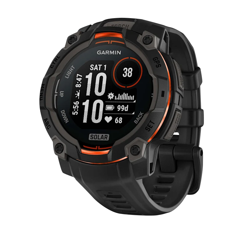
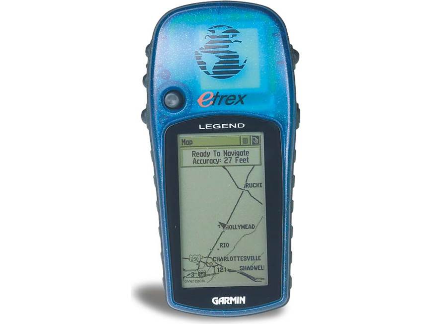
Handheld GPS units are built for outdoor navigation. Hikers, campers, hunters, and geocachers may use them to record tracks, save waypoints, and follow routes away from roads. Many handheld models are designed with physical buttons or rugged housings, which can be useful when wearing gloves or navigating in challenging weather.
Look at battery life, screen readability, water resistance, map compatibility, and ease of entering coordinates. Some units use replaceable batteries, while others have rechargeable batteries. The right option depends on how long you expect to be away from a power source.
GPS Devices for Cycling and Other Activities
Garmin also offers GPS devices intended for activities such as cycling and boating. These units may provide activity-specific information in addition to navigation, such as ride data or marine charts. Check that a device supports the maps, mounting accessories, sensors, and data fields you want before purchasing.
Features to Consider
- Maps and coverage: Confirm that the device includes or supports maps for the places you plan to visit.
- Offline use: Determine whether the maps and routing features can be used without a cellular connection.
- Battery and power: Compare expected battery life and charging options for your typical trips.
- Display: Consider screen size, visibility in sunlight, touch controls, and use with gloves.
- Durability: For outdoor use, review the device’s water resistance and construction.
- Mounting and accessories: Check whether the required vehicle, bicycle, or handheld accessories are included or sold separately.
- Updates and connectivity: Review how maps and software are updated and whether a computer, Wi-Fi, or phone connection is required.
Portable GPS vs. Smartphone Navigation
Smartphones are convenient and often provide live traffic, online searches, and familiar navigation apps. However, phone navigation can depend on mobile coverage, battery life, and a stable mounting setup. A dedicated GPS unit may offer a more focused interface, activity-specific controls, or maps available offline, depending on the model.
Neither option is perfect for every trip. Some travelers use a portable GPS as their primary navigator and keep a phone as a backup. For remote areas, it is wise to plan ahead, download or update maps when needed, carry spare power, and understand the limits of your equipment.
How to Choose a Garmin Portable GPS
Start by identifying your main use. Drivers should focus on road maps, screen placement, and routing features. Hikers should prioritize battery life, durable construction, readable maps, and waypoint tools. Cyclists and boaters should look for devices and maps designed for their activity.
Next, compare the specific device’s map coverage, update process, power requirements, and compatibility with accessories. Product features can differ significantly between models and may change over time, so consult Garmin’s current product information and user documentation before making a decision.
Final Thoughts
Garmin portable GPS units are available for a range of navigation needs, from road trips to outdoor adventures. Choosing the right one means matching the device to your activity, checking map and power requirements, and understanding which features are included. With the right preparation, a portable GPS can be a useful navigation tool at home and on the road.
8 Key Benefits of Garmin Portable GPS Units
- Reliable satellite-based navigation
- Useful offline map options
- Clear turn-by-turn directions
- Models for driving and outdoor use
- Helpful waypoint and route tools
- Dedicated screens for navigation
- Options with rugged designs
- Can reduce reliance on phone data
7 Drawbacks of Garmin Portable GPS Units
- Some models are expensive.
- Map updates may require extra steps.
- Touchscreens can be hard to use with gloves.
- Battery life varies by model.
- Some features require a phone connection.
- Screens may be small compared with phones.
- Satellite reception can weaken under dense cover.
Reliable satellite-based navigation
Garmin portable GPS units use satellite signals to determine your location and provide navigation, making them useful when cellular coverage is limited or unavailable. With compatible maps and a clear view of the sky, a unit can help you follow routes, mark destinations, and stay oriented on road trips or outdoor adventures without depending entirely on a mobile data connection.
Useful offline map options
Garmin portable GPS units can be useful when you’re traveling beyond reliable cellular coverage. Many models support onboard maps, so you can view your location and navigate without depending on a mobile data connection. Offline map availability and features vary by device, so check the model’s map coverage and update options before your trip.
Clear turn-by-turn directions
Garmin portable GPS units provide clear turn-by-turn directions to help drivers follow a route with confidence. Depending on the model, spoken prompts and easy-to-read on-screen instructions can show when to turn, which lane to use, and how far it is to the next maneuver. This guidance can make unfamiliar roads easier to navigate and reduce the need to repeatedly check a phone or map.
Models for driving and outdoor use
Garmin portable GPS units are available in models designed for both driving and outdoor adventures, making it easier to choose a device suited to your needs. A driving navigator can provide road maps and turn-by-turn directions, while an outdoor handheld may offer tools for recording tracks, saving waypoints, and navigating trails. This range lets travelers select purpose-built features for their activities rather than relying on one device for every situation.
Helpful waypoint and route tools
Garmin portable GPS units can make trip planning easier with waypoint and route tools that help you mark important locations and navigate between them. Save points such as trailheads, campsites, parking areas, or favorite destinations, then use them to build or follow a route. These tools can also help you retrace your steps or organize a trip with multiple stops, making navigation more manageable whether you’re driving or exploring outdoors.
Dedicated screens for navigation
Garmin portable GPS units feature dedicated screens designed specifically for navigation, making directions easy to view at a glance while driving or exploring. Their clear maps and on-screen prompts help keep route information separate from phone calls, messages, and other app notifications, so you can focus on where you’re going.
Options with rugged designs
Some Garmin portable GPS units feature rugged designs made for demanding outdoor use. Depending on the model, a durable housing and water-resistant construction can help the device handle rain, dust, and bumps on hiking, camping, or boating trips. This added resilience can make a rugged GPS a practical choice when a smartphone or standard navigator may be more vulnerable to the elements. Always check the model’s specifications to confirm its durability rating and intended conditions.
Can reduce reliance on phone data
Garmin portable GPS units can reduce reliance on phone data by providing navigation through satellite signals and, on compatible models, maps stored directly on the device. This can be especially useful in areas with weak cell service or when you want to save mobile data while traveling. Check your unit’s map coverage and offline features before a trip, since capabilities vary by model.
Some models are expensive.
Some Garmin portable GPS units can be expensive, especially models with detailed maps, advanced navigation tools, larger displays, or activity-specific features. The initial price may not include every accessory or map update, so it’s worth checking the total cost before buying. If you only need basic navigation, a simpler model may offer better value.
Map updates may require extra steps.
Map updates on Garmin portable GPS units may require a few extra steps, such as connecting the device to a computer or Wi-Fi, installing update software, and following prompts to download and install new maps. The process can take time, especially when updates are large or the device has limited storage. Checking the instructions for your specific model and updating before a trip can help prevent delays.
Touchscreens can be hard to use with gloves.
One drawback of some Garmin portable GPS units is that their touchscreens can be difficult to use while wearing gloves. Tapping small buttons or entering information may require removing your gloves, which can be inconvenient in cold weather or during outdoor activities. If you often navigate with gloves on, consider a model with physical buttons or a touchscreen designed to work with gloves.
Battery life varies by model.
Battery life varies by Garmin portable GPS model, so runtime may be shorter or longer depending on the device and how it’s used. Screen brightness, navigation settings, wireless connections, and temperature can also affect how long a charge lasts. Before a trip, check the manufacturer’s estimated battery life for your specific model and consider bringing a charger, spare batteries, or a power bank if you’ll be away from an outlet.
Some features require a phone connection.
Some Garmin portable GPS units rely on a paired smartphone for certain features, such as live traffic, weather updates, or connected notifications. This can be inconvenient when your phone is unavailable, its battery is low, or cellular service is limited. Before buying, check which features work independently and which require a phone connection or compatible app.
Screens may be small compared with phones.
One drawback of some Garmin portable GPS units is that their screens may feel small compared with a modern smartphone. Smaller displays can make maps, street names, and route details harder to see at a glance, especially while driving or navigating outdoors. If screen visibility matters to you, compare display sizes and readability before choosing a device.
Satellite reception can weaken under dense cover.
One drawback of Garmin portable GPS units is that satellite reception can weaken under dense cover, such as thick forests, deep canyons, or areas surrounded by tall buildings. When the device has a limited view of the sky, it may take longer to determine your location or provide less consistent tracking. Before heading into remote terrain, download the maps you need, save important waypoints, and consider carrying a paper map or another backup navigation option.