Garmin Handheld Marine GPS: A Practical Guide for Boaters
A Garmin handheld marine GPS can help boaters determine their position, follow a route, and mark important locations on the water. Its compact design makes it useful as a portable navigation tool, a backup for a boat’s fixed electronics, or an option for small craft where a permanently installed chartplotter may not be practical.
What a Handheld Marine GPS Can Do
Features vary by model, but many Garmin handheld GPS devices are designed to support essential navigation tasks, such as:
- Show your position: View your location using satellite-based positioning.
- Save waypoints: Mark locations such as a launch ramp, fishing spot, harbor entrance, or anchorage.
- Plan routes: Create or follow routes using saved waypoints and, on compatible models, chart data.
- Track movement: Record a track so you can review or retrace a journey.
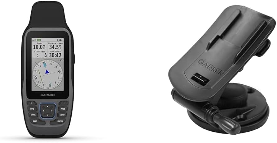
- Display navigation information: Depending on the model, this may include a compass, distance, speed, and estimated arrival information.
Not every handheld has the same capabilities. Some models offer a basic GPS display, while others may support marine charts, wireless connections, or additional sensors. Check the specifications for the exact device before buying.
Why Choose a Handheld GPS for Marine Use?
Portability is one of the main advantages. A handheld unit can move between boats and can be kept close at hand rather than installed at a helm. It may also provide a useful backup if a boat’s primary navigation display loses power or stops working.
Handheld devices can be especially convenient for kayaks, small fishing boats, tenders, and other craft with limited space. They can also help when scouting a route or marking a location away from the boat. A lanyard, protective case, and secure mounting solution can make a unit easier to use on deck.
Charts, Maps, and Coverage
A GPS receiver can show your position without necessarily displaying detailed marine charts. Before purchasing, confirm whether the model includes suitable mapping, supports optional chart downloads, or requires a separate map purchase. Also check that the chart coverage is appropriate for the waters you plan to navigate.
Chart availability and features can vary by model and region. Review Garmin’s current product information and chart compatibility details, and make sure maps are installed and updated before departure. A chart display is a navigation aid, not a replacement for observing conditions, reading official notices, or understanding local hazards.
Choosing the Right Garmin Handheld
Consider how and where you will use the device. These questions can help narrow your options:
- Do you need marine charts? Confirm chart support and coverage for your area.
- How will you carry or mount it? Compare screen size, button layout, and available mounting accessories.
- Will it be exposed to water? Check the device’s stated water-resistance rating and use a suitable case when appropriate.
- How long will you be away from shore? Review battery type, expected battery life, and whether spare batteries or a charging option are practical.
- Do you need connectivity or extra sensors? Check compatibility rather than assuming that every model supports wireless features, a compass, or other accessories.
- Can you read the screen in your usual conditions? Consider display size, brightness, and usability in direct sunlight.
Using a Handheld Marine GPS Safely
Set up the device before leaving the dock. Install the appropriate maps, check the battery, confirm the position display, and practice creating a waypoint and route. Save key locations in advance, but verify that each route makes sense for your boat, draft, speed, and current conditions.
Keep the device secured and protected from impact, spray, and accidental loss. A GPS can help you understand where you are, but it does not automatically account for every hazard, changing depth, traffic situation, weather condition, or temporary restriction. Maintain a lookout and use appropriate nautical charts and other navigation resources.
A handheld GPS should not be the only safety or navigation tool on board. Carry required safety equipment, have a backup plan, and know how to navigate if the device is unavailable. Always follow applicable boating regulations and manufacturer instructions.
Is a Garmin Handheld Marine GPS Right for You?
A Garmin handheld marine GPS may be a good fit if portability, waypoint marking, and a convenient backup are priorities. The right choice depends on the specific model, its chart support, battery setup, screen, and compatibility with the accessories you need. Comparing those details before purchase can help you find a device suited to your boat and the waters you explore.
Garmin Handheld Marine GPS: 7 Frequently Asked Questions
- What is the best Garmin handheld marine GPS for boating?
- Does a Garmin handheld GPS come with marine charts?
- Can a Garmin handheld marine GPS work without cell service?
- Are Garmin handheld GPS devices waterproof or floatable?
- How long does the battery last on a Garmin handheld marine GPS?
- Can I use a Garmin handheld GPS to mark fishing spots and create routes?
- How do I update maps and software on a Garmin handheld marine GPS?
What is the best Garmin handheld marine GPS for boating?
The best Garmin handheld marine GPS for boating depends on your needs and the waters you navigate. Look for a model with compatible marine charts for your area, a clear display that’s easy to read in sunlight, dependable battery life, and a water-resistance rating suited to conditions on board. If you want a backup for a boat’s chartplotter, prioritize portability and simple waypoint navigation; for more detailed route planning, choose a model with the charting and connectivity features you need. Check the exact model’s specifications and chart compatibility before buying, since features vary.
Does a Garmin handheld GPS come with marine charts?
It depends on the model. Some Garmin handheld GPS units include built-in marine charts, while others provide basic GPS navigation or require compatible charts to be purchased and added separately. Before buying, check the product specifications for included maps, chart compatibility, and coverage for the waters you plan to navigate.
Can a Garmin handheld marine GPS work without cell service?
Yes. A Garmin handheld marine GPS can determine your location using satellite signals, so it does not need cell service to provide basic GPS positioning. Navigation features that rely on maps require the relevant charts to be preloaded or otherwise available on your specific model; connected services, such as weather updates or data sharing, may require a phone connection or other network access. Check your model’s chart and connectivity features before heading out.
Are Garmin handheld GPS devices waterproof or floatable?
Garmin handheld GPS devices vary in their water resistance and buoyancy, so check the specifications for the exact model. Some are rated to withstand temporary immersion, but that does not mean they will float if dropped overboard. Unless the product documentation specifically says it floats, use a compatible flotation lanyard or case and follow Garmin’s care instructions.
How long does the battery last on a Garmin handheld marine GPS?
Battery life on a Garmin handheld marine GPS varies by model, battery type, and how the device is used. Frequent GPS updates, a bright backlight, wireless features, and cold weather can shorten runtime, while lower screen brightness and power-saving settings may help extend it. Check the specifications for your exact model, and consider carrying spare batteries or a suitable charging option for longer trips.
Can I use a Garmin handheld GPS to mark fishing spots and create routes?
Yes. Most Garmin handheld GPS units let you save waypoints to mark fishing spots and other locations, then use those waypoints to create or follow routes. Features vary by model, so check whether your device supports route planning and marine charts, and confirm that the maps cover the waters you fish. Save and organize your waypoints before heading out, and treat GPS information as a navigation aid rather than a substitute for charts, local knowledge, and safe boating practices.
How do I update maps and software on a Garmin handheld marine GPS?
To update maps and software on a Garmin handheld marine GPS, connect the device to a computer or Wi-Fi network, depending on the model, and use Garmin Express or the device’s built-in update feature. In Garmin Express, add or select your device, then follow the prompts to install available software and compatible chart updates. Before starting, check that the device is supported, use a reliable internet connection, and keep it connected to power during the update. Update steps and chart availability vary by model, so consult the device’s manual and Garmin’s support site for instructions specific to your unit.